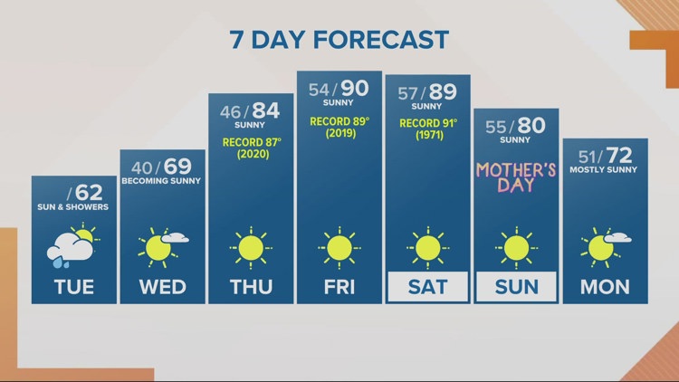
PORTLAND, Oregon — Spotty showers continue today. Morning snow levels in the Cascades are near 3,500 and will rise above 4,000' this afternoon.
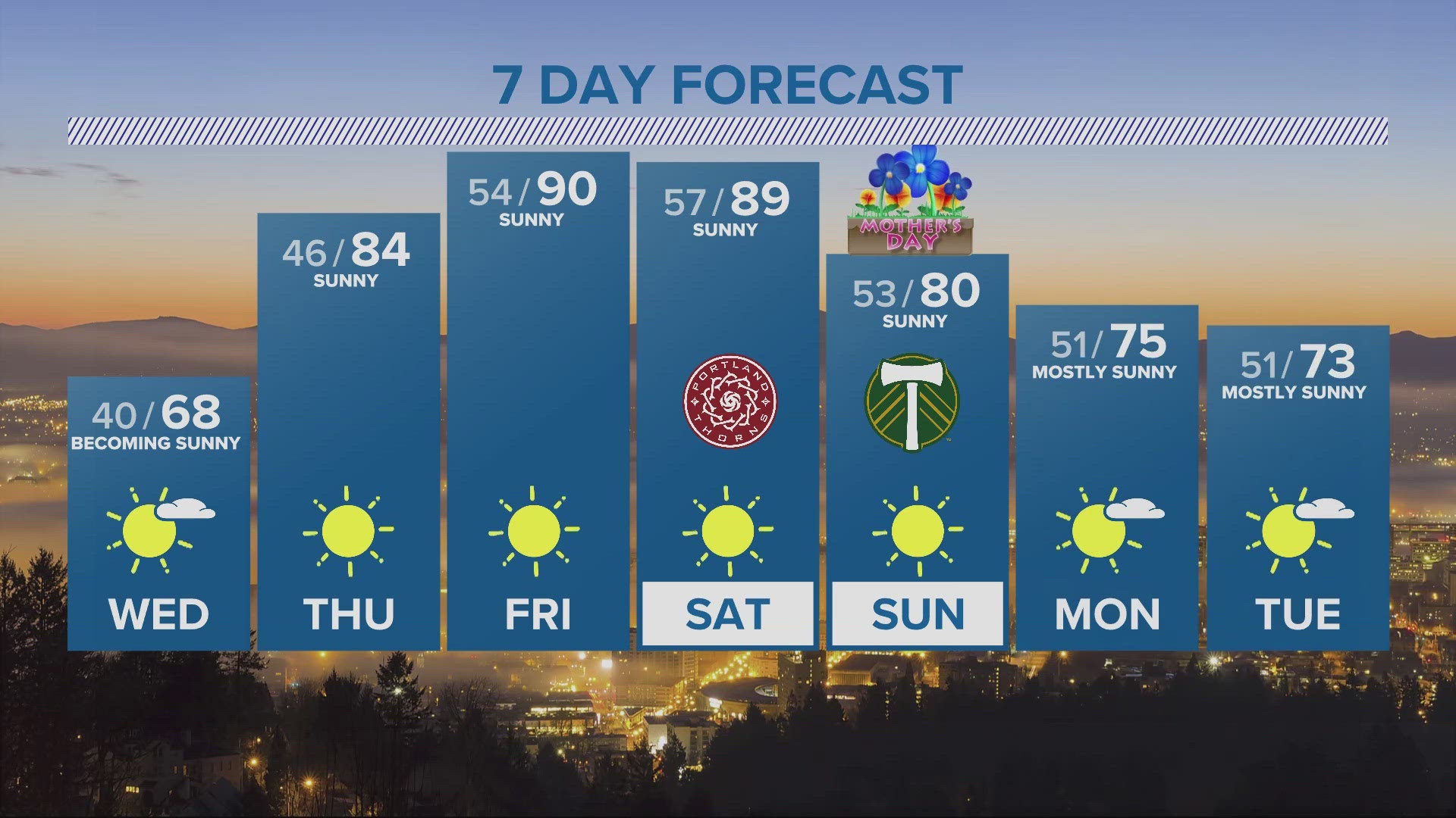
We've got one more day of showers & sunbreaks, and then we're done with the rain for at least a week -possibly more.
High temperatures today range from about 58° to 62° across the Portland-Vancouver Metro area. The sky clears tonight setting the stage for some patchy frost. We won't see frost in town tonight, but there is a Frost Advisory overnight for surrounding communities from midnight to 8 A.M. Wednesday.
After a chilly start Wednesday morning, temperatures warm to near 70-degees with full sunshine Wednesday afternoon.
We get a little taste of summer starting Thursday and we may be challenging record highs through Saturday.
Thursday's Forecast High: 84° (Record High: 87° / 2020 )
Friday's Forecast High: 90° (Record High: 89° / 2019 )
Saturday's Forecast High: 89° (Record High: 91° / 1971 )
We dial back the heat for Mother's Day Sunday, with high near 80° and we should keep temps in the 70s next Monday & Tuesday.
Have a great Tuesday
Chris McGinness
KGW Meteorologist
Extended weather reports and more on KGW+: You asked for more access to local news, weather and more at home, and we listened! Now, watching KGW News is easier than ever with the KGW+ app for Roku, Amazon Fire TV and Apple TV. Easily find live newscasts and local programs, access top videos and stream breaking news on your schedule. KGW+ offers 24-7 streaming that includes live local news, newscast replays, extended coverage, expanded weather reports, station specials and investigations. Click or tap here to learn more.